Gondwana Rainforests
| UNESCO World Heritage Site | |
|---|---|
 Box Log Falls, Lamington National Park in Queensland | |
| Location | New South Wales and Queensland, Australia |
| Criteria | Natural: viii, ix, x |
| Reference | 368 |
| Inscription | 1986 (10th Session) |
| Extensions | 1994 |
| Area | 370,000 ha (1,400 sq mi) |
Australian National Heritage List | |
| Type | National Heritage (Landscape) |
| Designated | 15 May 2007 |
| Reference no. | 105135 |
Class | Natural |
New South Wales Heritage Register | |
| Type | State Heritage (Landscape) |
| Designated | 2 April 1999 |
| Reference no. | 1002 |
Type | Wilderness |
Category | Natural |
The Gondwana Rainforests of Australia, formerly known as the Central Eastern Rainforest Reserves, are a World Heritage Site, encompassing 41 rainforest reserves with a total area of approximately 370,000 ha (910,000 acres) in north-east New South Wales and south-east Queensland. The site was added to the World Heritage List in 1986 and was expanded in 1994. The Gondwana Rainforests are also listed on the Australian National Heritage List and the New South Wales Heritage Register.
The Gondwana Rainforests are home to a number of plant and animal species whose lineages trace back to before the separation of the landmass Gondwana, some of which are only found in the region. These include early examples of ferns, conifers, and flowering plants. The reserves that make up the site are among the last remaining examples of the rainforests that covered most of Australia at the time of its separation from Gondwana. The Gondwana Rainforests are the world's most significant subtropical rainforests and include almost all of the world's Antarctic beech cool temperate rainforests.[1][2][3]
History
Australia separated from the landmass Gondwana about 40 million years ago, at which point most of the continent was covered in rainforests. These rainforests receded as the continent travelled north, and by 1788, just 1% of Australia was covered by rainforests.[1][2] These rainforests were used by Aboriginal Australians for varied purposes, including as a site for ceremonial activities, as a source of food and shelter, and as a refuge from European settlement.[4] Australia's remaining rainforests were heavily affected by logging following European colonisation, which led to the destruction of a further 75% of the rainforests that had been present in 1788.[1][2]
In 1986, the Central Eastern Rainforest Reserves (Australia) were inscribed onto the World Heritage List at the tenth session of the World Heritage Committee. The site was deemed to meet criteria 8 (displaying significant ongoing geological processes), criteria 9 (displaying significant ongoing ecological and biological processes), and criteria 10 (containing significant natural habitats of conservation significance) of the selection criteria for natural sites. The borders of the World Heritage Site were expanded in 1994, increasing its total area by 35%. In 2007, the site's name was changed to the Gondwana Rainforests of Australia.[1][5] Australia added a further expansion of the site to its Tentative List in 2010.[1][6]
The Gondwana Rainforests of Australia were added to the Australian National Heritage List on 15 May 2007 and to the New South Wales Heritage Register on 2 April 1999.[3][7]: 30 The site receives around 2 million visitors each year, and many of the rainforest reserves contain visitor facilities and walking trails.[1][3][8] The Gondwana Rainforests are primarily managed by the Queensland Parks and Wildlife Service and by the New South Wales National Parks and Wildlife Service.[7]: 30
Features and conservation
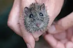
The reserves that make up the Gondwana Rainforests are home to more than 200 rare and threatened species and are a habitat for large populations of marsupials, birds, snakes, and frogs.[3] About 45 species of frog, 110 species of reptile, and 270 species of bird have been recorded in the area.[9] Plant species of conservation significance in the Gondwana Rainforests include species of Cryptocarya, Tasmannia, and Endiandra.[10] The site also contains the remains of two extinct volcanoes: the Tweed Shield Volcano—described as among the world's best preserved erosion calderas—and the Ebor Volcano.[1][11]: iv
The Gondwana Rainforests were severely damaged by the 2019–2020 Australian bushfire season, which affected about 53% of the site's land area.[2][12][7]: 4 The parma wallaby, Hastings River mouse, rufous scrubbird, and nightcap oak were among the species most heavily impacted by the fires.[7]: 20–21 Ongoing threats to the Gondwana Rainforests include weeds and invasive species, including myrtle rust and bitou bush, pathogens, and climate change.[1][12][10]
Sites
| Name | UNESCO ID | State | Coordinates | Area |
|---|---|---|---|---|
| Border Ranges National Park | 368-001 | New South Wales | 29°39′13″S 152°53′17″E / 29.65361°S 152.88806°E | 31,229 ha (77,170 acres) |
| Limpinwood Nature Reserve | 368-002 | 28°17′51″S 153°10′51″E / 28.29750°S 153.18083°E | 2,646 ha (6,540 acres) | |
| Numinbah Nature Reserve | 368-003 | 28°14′37″S 153°17′13″E / 28.24361°S 153.28694°E | 858 ha (2,120 acres) | |
| Mount Nothofagus Flora Reserve | 368-004 | 28°17′30″S 152°36′37″E / 28.29167°S 152.61028°E | 650 ha (1,600 acres) | |
| Mount Warning National Park | 368-005 | 28°23′38″S 153°16′14″E / 28.39389°S 153.27056°E | 2,380 ha (5,900 acres) | |
| Nightcap National Park | 368-006 | 28°32′24″S 153°16′56″E / 28.54000°S 153.28222°E | 1,110 ha (2,700 acres) | |
| Washpool National Park | 368-007 | 29°22′21″S 152°20′5″E / 29.37250°S 152.33472°E | 27,715 ha (68,490 acres) | |
| Gibraltar Range National Park | 368-008 | 29°27′31″S 152°21′25″E / 29.45861°S 152.35694°E | 17,273 ha (42,680 acres) | |
| Iluka Nature Reserve | 368-009 | 29°24′14″S 153°21′44″E / 29.40389°S 153.36222°E | 136 ha (340 acres) | |
| New England National Park | 368-010 | 30°28′19″S 152°28′55″E / 30.47194°S 152.48194°E | 29,985 ha (74,090 acres) | |
| Dorrigo National Park (part) | 368-011 | 30°21′9″S 152°48′26″E / 30.35250°S 152.80722°E | 7,885 ha (19,480 acres) | |
| Mount Hyland Nature Reserve | 368-012 | 30°9′49″S 152°26′28″E / 30.16361°S 152.44111°E | 1,636 ha (4,040 acres) | |
| Werrikimbe National Park | 368-013 | 31°9′59″S 152°15′11″E / 31.16639°S 152.25306°E | 35,178 ha (86,930 acres) | |
| Mount Seaview Nature Reserve | 368-014 | 31°20′5″S 152°11′1″E / 31.33472°S 152.18361°E | 1,703 ha (4,210 acres) | |
| Willi Willi National Park | 368-015 | 31°8′47″S 152°25′31″E / 31.14639°S 152.42528°E | 1,610 ha (4,000 acres) | |
| Barrington Tops National Park | 368-016 | 31°56′11″S 151°29′11″E / 31.93639°S 151.48639°E | 39,120 ha (96,700 acres) | |
| Springbrook National Park (part) | 368-017 | Queensland | 28°12′23″S 153°17′46″E / 28.20639°S 153.29611°E | 2,480 ha (6,100 acres) |
| Lamington National Park | 368-018 | 28°8′45″S 153°6′50″E / 28.14583°S 153.11389°E | 20,500 ha (51,000 acres) | |
| Mount Chinghee National Park | 368-019 | 28°18′3″S 152°56′51″E / 28.30083°S 152.94750°E | 1,110 ha (2,700 acres) | |
| Mount Barney National Park (part) | 368-020 | 28°16′49″S 152°39′36″E / 28.28028°S 152.66000°E | 9,710 ha (24,000 acres) | |
| Main Range National Park | 368-021 | 27°54′7″S 152°19′8″E / 27.90194°S 152.31889°E | 11,500 ha (28,000 acres) | |
| Mount Mistake National Park (part) | 368-022 | 27°51′46″S 152°21′6″E / 27.86278°S 152.35167°E | 11,500 ha (28,000 acres) | |
| Turtle Rock Environmental Park | 368-023 | 28°11′53″S 153°13′4″E / 28.19806°S 153.21778°E | 68.8 ha (170 acres) | |
| Telemon Environmental Park | 368-024 | 28°9′0″S 152°55′35″E / 28.15000°S 152.92639°E | 146.6 ha (362 acres) | |
| Goomburra State Forest | 368-025 | 27°58′40″S 152°21′5″E / 27.97778°S 152.35139°E | 2,067 ha (5,110 acres) | |
| Spicers Gap State Forest | 368-026 | 28°4′30″S 152°24′38″E / 28.07500°S 152.41056°E | 257 ha (640 acres) | |
| Gilbert State Forest | 368-027 | 28°6′58″S 152°22′16″E / 28.11611°S 152.37111°E | 84 ha (210 acres) | |
| Emu Vale State Forest | 368-028 | 26°16′18″S 149°25′47″E / 26.27167°S 149.42972°E | 268 ha (660 acres) | |
| Gambubal State Forest | 368-029 | 28°13′59″S 152°21′55″E / 28.23306°S 152.36528°E | 2,260 ha (5,600 acres) | |
| Teviot State Forest | 368-030 | 28°13′8″S 152°28′26″E / 28.21889°S 152.47389°E | 390 ha (960 acres) | |
| Killarney State Forest | 368-031 | New South Wales | 30°14′6″S 149°51′46″E / 30.23500°S 149.86278°E | 494 ha (1,220 acres) |
| Burnett Creek State Forest | 368-032 | Queensland | 28°14′26″S 152°35′5″E / 28.24056°S 152.58472°E | 1,076 ha (2,660 acres) |
| Cronan Creek State Forest | 368-033 | 28°18′9″S 152°41′42″E / 28.30250°S 152.69500°E | 795 ha (1,960 acres) | |
| Palen Creek State Forest | 368-034 | 28°16′28″S 152°48′39″E / 28.27444°S 152.81083°E | 326 ha (810 acres) | |
| Rabbitt Board Paddock Reserves | 368-035 | 26°51′39″S 150°47′51″E / 26.86083°S 150.79750°E | 143 ha (350 acres) | |
| Prison Purposes Land | 368-036a | — | 48 ha (120 acres) | |
| Wilsons Peak Flora Reserve | 368-037 | New South Wales | 28°14′53″S 152°29′15″E / 28.24806°S 152.48750°E | 185 ha (460 acres) |
| Mount Clunie Flora Reserve | 368-038 | 28°14′26″S 152°35′5″E / 28.24056°S 152.58472°E | 485 ha (1,200 acres) | |
| Amaroo Flora Reserve | 368-039 | 28°22′51″S 153°14′5″E / 28.38083°S 153.23472°E | 36 ha (89 acres) | |
| Fenwicks Scrub Flora Reserve | 368-040 | 31°16′58″S 152°8′48″E / 31.28278°S 152.14667°E | 110 ha (270 acres) | |
| Kerripit Beech Flora Reserve | 368-041 | 32°1′54″S 151°33′4″E / 32.03167°S 151.55111°E | 243 ha (600 acres) |
Maps
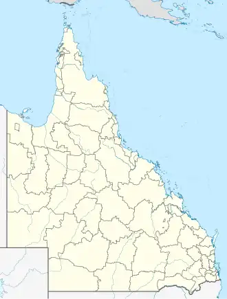  Location of sites in Queensland |
 Location of sites in New South Wales |
See also
- Forests of Australia
- List of World Heritage Sites in Australia
References
- ^ a b c d e f g h i "Gondwana Rainforests of Australia". UNESCO World Heritage Centre. Retrieved 31 March 2026.
- ^ a b c d Kooyman, Robert M.; Watson, James; Wilf, Peter (2020). "Protect Australia's Gondwana Rainforests". Science. 367 (6482): 1083. JSTOR 26906949.
- ^ a b c d "Gondwana Rainforests of Australia". New South Wales State Heritage Register. Department of Climate Change, Energy, the Environment and Water. Retrieved 31 March 2026.
- ^ McIntyre-Tamwoy, Susan (2008). "Archaeological Sites & Indigenous Values: The Gondwana Rainforests of Australia World Heritage Area". Archaeological Heritage. 1: 42–49.
- ^ "Extension and Change of Name: Central Eastern Rainforest Reserves - Extension of the Australian East Coast Temperate & Subtropical Rainforest Park (Australia)". UNESCO World Heritage Centre. 1994. Retrieved 1 April 2026.
- ^ "The Gondwana Rainforests of Australia World Heritage Area (extension to existing property)". UNESCO World Heritage Centre. Retrieved 1 April 2026.
- ^ a b c d Gondwana Rainforests of Australia State of Conservation Update (Report). Department of Agriculture, Water and the Environment. 2020. Retrieved 31 March 2026.
- ^ "Gondwana Rainforests of Australia World Heritage Area (Queensland Section)". Department of the Environment, Tourism, Science and Innovation. Retrieved 31 March 2026.
- ^ McGinley, Mark (9 December 2008). "Central Eastern Rainforest Reserves, Australia". Encyclopedia of Earth. United Nations Environment Programme: World Conservation Monitoring Centre. Archived from the original on 16 October 2009. Retrieved 1 July 2009.
- ^ a b "Gondwana Rainforests of Australia". Australian Heritage Database. Department of Climate Change, Energy, the Environment and Water. Retrieved 31 March 2026.
- ^ Hunter, R. John (2004). "World Heritage and Associative Natural Values of the Central Eastern Rainforest Reserves of Australia" (PDF). NSW National Parks & Wildlife Service (PDF). Government of New South Wales. Archived from the original (PDF) on 31 March 2011.
- ^ a b "Gondwana Rainforests of Australia - State of Conservation". UNESCO World Heritage Centre. 2025. Retrieved 31 March 2026.