Autoroutes of France
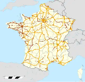
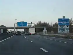
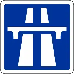
The autoroute (French: [otoʁut] ⓘ, highway or motorway) system in France consists largely of toll roads (76% of the total). It is a network of 11,882 km (7,383 mi) of motorways as of 2014. On road signs, autoroute destinations are shown in blue, while destinations reached through a combination of autoroutes are shown with an added autoroute logo. Toll autoroutes are signalled with the word péage (toll or toll plaza). All are in metropolitan France except for the A1 (972) in Martinique.
| Source: Observatoire national interministériel de la sécurité routière.[1] |
Length
Source ASFA.,[2] ASFA 2018;[3] Eurostat (road_if_motorwa serie)[4] View source data. |
Numbering scheme
Unlike other motorway systems, there is no systematic numbering system, but there is a clustering of Autoroute numbers based on region.
A1, A3, A4, A5, A6, A10, A13, A14, A15, A16 radiate clockwise from Paris, with A2, A11, and A12 branching from A1, A10, and A13, respectively. A7 begins in Lyon, where A6 ends. A8 and A9 begin from the A7.
The 20s are found in northern and northwestern France. The 30s are found in eastern and northeastern France. The 40s are found near the Alps. The 50s are in the southeast, near the French Riviera. The 60s are found in southern France. The 70s are found in the center of the country. The 80s are found in western France, except for the A89 autoroute which goes from southwestern to eastern France.
Named routes
Autoroutes are often given a name, even if these are not very used:
- A1 is the autoroute du Nord (Northern motorway).
- A4 is the autoroute de l'Est (Eastern motorway).
- A6 and A7 are autoroutes du Soleil (Motorways of the Sun), as both lead from northern France to the sunny beach resorts of southern France.
- A8 is named La provençale as it cross the geographical region of Provence.
- A9 is named La Languedocienne as it crosses the geographic region of Languedoc and also La Catalane because it leads to the region Catalonia in Spain.
- A10 is named L'Aquitaine because it leads to Bordeaux and the region Nouvelle-Aquitaine.
- A11 is named L'Oceane because it leads to the Atlantic Ocean (Nantes).
- A13 is named the autoroute de Normandie as it traverses the region Normandy.
- A16 is named L'Européenne (the European) because it connects Paris with several European destinations such as the Belgium–France border, as well as Calais, which is connected with England.
- A20 is named L'occitane as it leads to the region Occitanie in south-west France.
- A21 is named the rocade minière (mining road) because it crosses the Nord-Pas de Calais Mining Basin, the largest mining stub in France.
- A26 is named the autoroute des Anglais (motorway of the English) as it connects Calais, the main point of arrival for cars and lorries from the UK, before continuing to Troyes, and through the Champagne region, whose wines are loved by the British. In addition, it passes near the sites of the most famous battles fought by the British Army in World War I, such as Arras, Cambrai, and the Somme and not far from Ypres and Mons in Belgium. It also passes sites of earlier UK interest such as Crecy and The Field of the Cloth of Gold.
- A35 is called l'Alsacienne or autoroute des Cigognes (Storks' motorways) as it passes only through the historical region of Alsace, for whom storks are a cultural symbol.
- A36 is called la Comtoise after the old region Franche Comté.
- A40 is named the autoroute blanche (white motorway) as it connects the French winter resort towns and the Alps.
- The A61 and A62 are named autoroute des deux mers (the two seas motorway) because these roads connect the Atlantic Ocean and the Mediterranean Sea from Bordeaux via Toulouse to Narbonne.
- A64 is the Autoroute to Pau, Bordeaux and Bayonne, accessible from Tarbes and Lourdes.
- A68 is called autoroute du Pastel because it leads to Albi and to the Lauragais where woad was cultivated to produce pastel.
- A71 is called L'Arverne.
- A75 is called La Méridienne.
- A77 is called Autoroute de l'Arbre.
- A84 is called Autoroute des Estuaires. It is part of the main route between Belgium and Spain, avoiding Paris.
- A104, one of Paris's beltways, is also known as La Francilienne because it circles the region of Ile-de-France.
Administration
The status of motorways in France has been the subject of debate through years, from their construction until recently. Originally, the autoroutes were built by private companies mandated by the French government and followed strict construction rules as described below. They are operated and maintained by mixed companies held in part by private interests and in part by the state. Those companies hold concessions, which means that autoroutes belong to the French state and their administration to semi-private companies. Vinci controls around 4,380 km (2,720 mi) of motorway. The different companies are as follows:
- ALIS (SEM, SAPN 8%, Bouygues 20.2%, Ixis 26%, DTP Terrassement 13.44%), operating the A28 Rouen-Alençon 125 km, Alis, official site
- APRR (Autoroutes Paris-Rhin-Rhône), 1801 km, APRR, official site
- AREA (Société des Autoroutes Rhône-Alpes, APRR Subsidiary at 99.82%), 381 km, AREA, official site
- ASF (Autoroutes du sud de la France), 2325 km, ASF, official site Archived 2006-12-06 at the Wayback Machine (bought by vinci-autoroutes.com Vinci)
- ATMB (Autoroutes et tunnels du Mont-Blanc), 107 km, ATMB, official site
- CEVM (Viaduc de Millau, groupe Eiffage), 2.5 km, CEVM, official site
- Cofiroute (Compagnie Industrielle et Financière des Autoroutes, private company part of Vinci group), 896 km, Cofiroute, official site
- Escota (Société des Autoroutes Esterel-Côte d'Azur, ASF group), 460 km, Escota, official site (bought by vinci-autoroutes.com Vinci)
- SANEF (Société des autoroutes du Nord et de l'Est de la France), A.C.S. group (Spain), 1317 km, SANEF, official site
- SANEF Paris Normandie (Société des autoroutes Paris-Normandie, SEM, groupe Sanef), 366 km, SAPN, official site
- SFTRF, Société française du tunnel routier du Fréjus, 67 km, SFRTF, official site
Only in the Brittany region do most of the autoroutes belong to the government. They are operated by the regional council and are free from tolls.
| Privately managed | |
|---|---|
View source data. |
View source data. |
| Source ASFA[2] | |
Safety on French autoroutes
Motorway speed limits
France has the following speed limits for limited access roads classified as motorways:
- Under normal conditions - 130 km/h (80 mph)
- In rain or wet road conditions - 110 km/h (70 mph)
- In heavy fog or snowy/icy conditions - 50 km/h (30 mph)
Limited access roads classified as express roads have lower speed limit (90 or 110 km/h, 55 or 70 mph).
In normal conditions, there is a minimum speed of 80 km/h (50 mph) in the leftmost lane. There is no minimum speed on the others lanes, however the speed must be adapted to the conditions and not constitute a hazard by being too slow.
Safe design
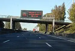
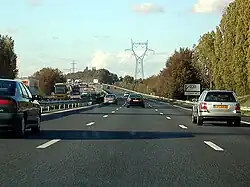
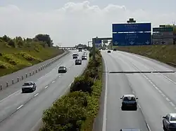
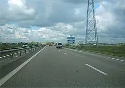
The autoroutes are designed to increase driver safety and allow for higher speed limits (130 km/h or 80 mph) than on regular roads (80 km/h or 50 mph) without increasing the risk of accidents.
The safety features include:
- one way driving: the lanes driving in the opposite direction are separated by at least a crash barrier designed to resist the oblique impact of a car at up to 180 km/h (110 mph); there are no intersecting roads but overpasses and underpasses;
- wider carriageways, with at least 2 (often 3) lanes driving in the same direction, with a larger turning radius - some recently built autoroutes have one-lane-only sections; for privately operated motorways, in 2017, the proportion is 6800 km (74%) in 2x2 lanes, 2252 km (25%) in 2x3 lanes, 84 km (1%) in 2x4 lanes.[2] Each lane is 3.5m wide.[5]
- long entrance and exit ramps or slip roads to get in or out of the autoroute without disturbing the traffic;
- an emergency lane, where it is forbidden to drive (except for emergency services), to park (except in case of emergency) and to walk;[6] Since 2000, new emergency lanes on newly built motorways should be 2.5m wide (or 3m if there are more than 2000 trucks a day). According to the 2000 standard, the emergency lane must be included in a 10m wide (8.5m for sections limited to 110 km/h) security zone without obstacles (in case the security zone includes an upwards slope, it is limited to the line where the slope reaches a height of 3m).[5]
- presence of emergency call boxes every 2 km (1.2 mi) on each side, that allow to call for help with the possibility to locate the call; some call boxes have flashing light that warn when there is a problem ahead;

- rest areas (aire de repos, i.e. car park with public toilets) every 10 km (6.2 mi) (4–6 minutes of driving) and service areas (aire de service with a least a gas station) every 40 km (25 mi) (20–30 minutes of driving) - on most recently built autoroutes these distances may be longer, up to 30/60km;
- regularly patrolling security services, to clear any obstacle and protect drivers in trouble (usually a breakdown or a flat tyre) with appropriate warning signs and beacons;
- dynamic information panels that warn about possible difficulties ahead (e.g. accident, roadworks, traffic jam);
- a radio station (107.7 MHz in FM) provides traffic information bulletins every 15 minutes (with a report in English in certain areas) and breaking news for emergencies;
- on heavy traffic days (e.g. beginning and end of school holidays), specific information and recreation events may be organised in rest areas;
- radars automatiques (speed cameras) are installed in many locations, and announced by a specific road sign.
Safety results
Fatalities on motorways have decreased between 2002 and 2016.
| Fatalities |
|---|
View source data. |
| Source ASFA[7][8] |
Fatalities accidents scenario
On French motorways, in 2016, 121 fatal accidents are direct/initial accidents representing 82% of fatal accidents, 16 (11%) fatal accidents occurs after a previous accident, and 10 (7%) fatal accidents occur after an incident.[8]
Three scenarios catch two-thirds of initial accidents:[8]
- A01 simple collision of two vehicle without direction change
- A06 crash on protection system such as safety traffic barrier
- A05 loss of vehicle control
Fatalities and accidents remaining factors
Most of fatalities occur by night.
| Fatal accident by Light condition | Fatal accident cause |
|---|---|
View source data. |
View source data. |
| Source Sécurité routière[9] | Source ASFA[2] |
Several factor of accidents are more highly probable by night in proportion to the traffic, although inattentiveness remains risky during the day.
| Influence of time on the risk of accident (% of accidents divided by % of traffic) |
|---|
View source data. |
View source data. |
View source data. |
View source data. |
View source data. |
View source data. |
| Source ASFA[8] |
Young drivers
Young drivers between 18 and 34 years old represent 19% of motorway drivers, but they are overrepresented in fatal motor vehicle collisions[7] and are involved in more than half of fatal accidents.[7]
| Involvement of young drivers in 2016, in fatal accidents | ||||
|---|---|---|---|---|
| young drivers in dangerous manoeuvre | young drivers in inattentiveness | young drivers in excessive speeding | ||
View source data. |
View source data. |
View source data. | ||
| Source ASFA[7] | ||||
Pedestrians
Although pedestrians are forbidden on motorways in conformity with the Vienna Convention, they are still sometimes killed on motorways.
In case a vehicle on a carriage cannot move, motorways safety rules remains applicable: it is forbidden for a pedestrian to travel on the motorway by article 421-2 from the "Code de la route" law.[10] For this reason, in case of accident or breakdown, it is advised to turn on hazard warning lights, wear high-visibility clothing, and go in a safer place such as the other side from the traffic barrier where there is no traffic. Since 2008, it is clarified that warning triangles are no longer mandatory when they would endanger the driver of the disabled vehicle.[11]
| Pedestrians killed in 2016 | ||
|---|---|---|
| Place where pedestrians are killed | Reason for pedestrian presence | |
View source data. |
View source data. | |
| Source ASFA | ||
Economics

The toll roads were granted as concessions to mixed-economy corporations; the free roads are directly administered by the national government. Tolls are either based on a flat-rate for access to the road or on the distance driven. The latter case is the most common for long distances; users take a ticket from an automatic machine when they enter the autoroute, and pay according to the distance when exiting; toll booths accept multiple payment methods.

In 2005, the Villepin government proposed a controversial plan to sell all of the state's holdings in autoroute companies to private investors. Critics contend that the price announced is well below the profit forecasts for these companies, and thus that the government sacrifices the future to solve current budgetary problems.[12]
| Mode of payment |
|---|
View source data. |
| Source ASFA[2][3] |
List of autoroutes
| Number | Length (km) | Length (mi) | Southern or western terminus | Northern or eastern terminus | Route name | Formed | Removed | Notes |
|---|---|---|---|---|---|---|---|---|
 A 1 A 1
|
211 | 131 | Boulevard Périphérique at Porte de la Chapelle, Paris | A25/N 356 in Lille | Autoroute du Nord | 1954 | current | Part of E 15 / E 17 / E 19 / E 42 |
 A 2 A 2
|
77.6 | 48.2 | A1 in Combles | Belgian border near Saint-Aybert | 1972 | current | Part of E 19 | |
 A 3 A 3
|
18.4 | 11.4 | Boulevard Périphérique at Porte de Bagnolet, Paris | A1 in Roissy-en-France | 1969 | current | Part of E 15 | |
 A 4 A 4
|
477 | 296 | Boulevard Périphérique at Porte de Bercy, Paris | Strasbourg | Autoroute de l'Est | 1970 | current | Part of E 17 / E 25 / E 46 / E 50 / E 54 |
 A 5 A 5
|
238 | 148 | N 104 in Tigery | A31 near Beauchemin | La Champenoise | 1990 | current | Part of E 17 / E 54 / E 511 |
 A 5a A 5a
|
— | — | A5 | N 104 | — | — | Western link between A 5 and N 104; renumbered to A5 | |
 A 5b A 5b
|
— | — | A5 | N 104 | — | — | Northern link between A 5 and N 104; renumbered to A105 | |
 A 6 A 6
|
446 | 277 | M 6 in Limonest | A6a/A6b in Wissous | Autoroute du Soleil | 1960 | current | Part of E 15 / E 21 / E 60 / E 70 |
 A 6a A 6a
|
10 | 6.2 | A6/A10 in Wissous | Boulevard Périphérique at Porte d'Orléans, Paris | Autoroute du Soleil | 1960 | current | Part of E 5 |
 A 6b A 6b
|
10 | 6.2 | A6/A10 in Wissous | Boulevard Périphérique at Porte d'Italie, Paris | Autoroute du Soleil | 1969 | current | Part of E 15 / E 50 |
 A 7 A 7
|
306 | 190 | Marseille | M 7 in Lyon | Autoroute du Soleil | 1951 | current | Part of E 15 / E 80 / E 712 / E 714 |
 A 8 A 8
|
224 | 139 | La Fare-les-Oliviers (A7) | Italy (A10) (Menton) | La Provençale | 1961 | current | Part of E 74 / E 80 |
 A 9 A 9
|
281 | 175 | Spanish border at Le Perthus | A7 in Orange | La Languedocienne La Catalane |
1960 | current | Part of E 15 / E 80 |
 A 10 A 10
|
557 | 346 | Rocade de Bordeaux (A630/N 230) in Bordeaux | A6a/A6b in Wissous | L'Aquitaine | 1960 | current | Part of E 5 / E 50 / E 60 / E 606 |
 A 11 A 11
|
323 | 201 | Périphérique (A844) in Nantes | A10 in Ponthévrard | L'Océane | 1966 | current | Part of E 50 / E 60 / E 501 |
 A 12 A 12
|
8.5 | 5.3 | N 10 in Montigny-le-Bretonneux | A13 in Bailly | Autoroute de Bretagne | 1950 | current | |
 A 13 A 13
|
225 | 140 | Périphérique (N 814) at Porte de Paris, Caen | Boulevard Périphérique at Porte d'Auteuil, Paris | Autoroute de Normandie | 1940 | current | Part of E 5 / E 46 / E 402 |
 A 13a A 13a
|
3 | 1.9 | A13 in Rosny-sur-Seine | D 113/D 915 in Bonnières-sur-Seine | Bretellede Bonnières-sur-Seine | — | — | Branch of A13 |
 A 14 A 14
|
21 | 13 | N 13 in La Défense | A13 in Orgeval | 1996 | current | ||
 A 15 A 15
|
24 | 15 | A86/N 315 in Gennevilliers | N 14 in Cergy | 1974 | current | ||
 A 16 A 16
|
312 | 194 | N 104 in Attainville | Belgian border in Ghyvelde | L'Européenne | 1991 | current | Part of E 15 / E 40 / E 44 / E 402 |
 A 17 A 17
|
— | — | Paris | Fontenay-sous-Bois | — | 1973 | Proposed but never built | |
 A 18 A 18
|
— | — | Paris | Marnes-la-Coquette / Versailles / Vélizy-Villacoublay / Le Chesnay | — | 1976 | Proposed but never built | |
 A 19 A 19
|
— | — | Paris | Rueil-Malmaison (A86) | 1965 | — | Proposed but never built | |
| A 19
|
— | — | Paris | Melun | — | — | Proposed but never built; later incorporated into the A5 | |
| A 19
|
131 | 81 | Artenay (A10) | Sens (A5) | L'Éco Autoroute | 1993 | current | Part of E 60 / E 511 |
 A 20 A 20
|
428 | 266 | Montauban (A62) | Vierzon (A71) | L'Occitane | 1992 | current | Part of E 9 / E 70 |
 A 21 A 21
|
58.9 | 36.6 | Bully-les-Mines (D 301 / A26) | Douchy-les-Mines (A2) | Rocade Minière | 1971 | current | |
 A 22 A 22
|
15.8 | 9.8 | Ronchin (A1) Villeneuve-d'Ascq (N 227) |
Villeneuve-d'Ascq (N 227) Belgian border in Neuville-en-Ferrain |
Autoroute du Nord | 1972 | current | Part of E 17; gap in route connected by N 227 |
 A 23 A 23
|
42.7 | 26.5 | Lesquin (A27) | La Sentinelle (A2) | 1978 | current | ||
 A 24 A 24
|
— | — | Amiens | Belgian border | 1980 | 2011 | Proposed but never built | |
 A 25 A 25
|
62.7 | 39.0 | Lille (A1) | Dinkirk (Dunkerque) | 1963 | current | Part of E 42 | |
 A 26 A 26
|
395 | 245 | Troyes (A5) | Calais (A16) | Autoroute des Anglais | 1976 | current | Part of E 15 / E 17 / E 50 |
 A 27 A 27
|
13.7 | 8.5 | Lesquin (A22) | Belgian border in Camphin-en-Pévèle | 1973 | current | Part of E 42 | |
 A 28 A 28
|
366.5 | 227.7 | Abbeville (A16) | Tours (A10) | Autoroute des Estuaires | 2005 | current | Part of E 44 / E 402 / E 502 |
 A 29 A 29
|
183 | 114 | Beuzeville (A13) | Saint-Quentin (A26) | 1995 | current | Part of E 44 / E 402 | |
 A 30 A 30
|
25 | 16 | Uckange (A31) | Crusnes (N 52) | Autoroute de la Vallée de la Fensch | 1963 | current | Part of E 44 / E 411 |
 A 31 A 31
|
351 | 218 | Beaune (A6) | Luxembourg border at Zoufftgen | Autoroute de Lorraine-Bourgogne | 1966 | current | Part of E 17 / E 21 / E 23 / E 25 / E 54 / E 60 |
| A 31 bis | — | — | Fameck | Thionville | proposed | — | ||
 A 32 A 32
|
— | — | Freyming-Merlebach (A4) | German border | 1972 | 1996 | Renumbered to A320 | |
| A 32
|
— | — | Toul | Luxembourg border | — | 2010 | Proposed but never built | |
 A 33 A 33
|
26.8 | 16.7 | Nancy (A31) | Hudiviller (N 4) | 1953 | current | Local autoroute around Nancy Part of E 23 | |
 A 34 A 34
|
98 | 61 | Reims (A4) | Sedan (N 43) | L'Ardennaise | 1973 | current | Part of E 44 / E 46 / E 420 |
 A 35 A 35
|
172 | 107 | Swiss border in Saint-Louis | German border in Scheibenhard | Autoroute des Cigognes L'Alsacienne |
1965 | current | Part of E 25 / E 60 |
 A 36 A 36
|
237 | 147 | A31 in Bourgogne-Franche-Comté | German border in Ottmarsheim | La Comtoise | 1986 | current | Part of E 54 / E 60 |
 A 37 A 37
|
— | — | Beaune | Dijon | 1974 | 1982 | Became a portion of the A31 | |
 A 38 A 38
|
37 | 23 | Pouilly-en-Auxois (A6) | Dijon (M 274) | La Côte-d'Orienne | 1973 | current | |
 A 39 A 39
|
144 | 89 | Dijon (M 905) | Bourg-en-Bresse (A40) | Autoroute Verte La Bressane |
1992 | current | |
 A 40 A 40
|
205.9 | 127.9 | Mâcon (A6) | Passy (N 205) (Mont Blanc Tunnel) | Autoroute Blanche Autoroute des Titans |
1973 | current | Part of E 21 / E 25 / E 62 |
 A 41 A 41
|
112.9 | 70.2 | Swiss border in Saint-Julien-en-Genevois | N 90/D 1090 in Meylan | LIANE (LIaison Annecy Nord Express) L'Alpine |
1975 | current | Part of E 21 / E 62 / E 70 / E 712 |
 A 42 A 42
|
52.3 | 32.5 | Lyon | Bourg-en-Bresse (Pont-d'Ain) (A40) | Autoroute de la Vallée du Rhône | 1987 | current | Part of E15 / E 611 |
 A 43 A 43
|
208 | 129 | Lyon | Italian border at the Fréjus Road Tunnel | Autoroute de la Maurienne | 1973 | current | Part of E 70 / E 711 / E 712 |
 A 44 A 44
|
— | — | Limonest (A6) | Vienne (A7) | — | — | Lyon western bypass proposed but never built | |
 A 45 A 45
|
— | — | Lyon | Saint-Étienne | 1993 | 2018 | Proposed but never built | |
 A 46 A 46
|
47.6 | 29.6 | Anse (A6) | Givors (A7 / A47) | La Lyonnaise | 1992 | current | Lyon eastern bypass Part of E 50 / E 70 |
 A 47 A 47
|
29.5 | 18.3 | Givors (A7 / A46) | Saint-Étienne (Saint-Chamond) (N 88) | L'Urbaine | 1962 | current | |
 A 48 A 48
|
52.5 | 32.6 | Bourgoin-Jallieu (A43) | Grenoble (A480) | Autoroute du Dauphiné | 1968 | current | Part of E 711 / E 713 |
 A 49 A 49
|
70.4 | 43.7 | Moirans (A48) | Romans-sur-Isère (N 532) | 1992 | current | Part of E 713 | |
 A 50 A 50
|
70 | 43 | Marseille | Toulon (A57) | 1962 | current | ||
 A 51 A 51
|
172 | 107 | Marseille (Septèmes-les-Vallons) (A7) Grenoble (Claix) (A480) |
Gap (La Saulce) Col du Fau |
Autoroute du val de Durance Autoroute du Trièves |
1953 | current | Part of E 712 |
 A 52 A 52
|
25.3 | 15.7 | Fuveau (A8) | Aubange (A50) | 1974 | current | ||
 A 54 A 54
|
49 | 30 | Nîmes (A9) | Salon-de-Provence (A7) | La Camarguaise | 1970 | current | Part of E 80 |
 A 55 A 55
|
36.7 | 22.8 | Marseille (La Joliette) | Martigues (RN 568) | Autoroute du Littoral | 1972 | current | |
 A 56 A 56
|
— | — | Salon (A54) | Fos-sur-Mer (A55) | proposed | — | ||
 A 57 A 57
|
52 | 32 | Toulon (A50) | Le Cannet-des-Maures (A8) | La Toulonnaise | 1964 | current | |
 A 58 A 58
|
— | — | Mandelieu-la-Napoule | La Turbie | — | 2006 | Proposed but never built; known as A8 bis until 1996 | |
 A 61 A 61
|
147.5 | 91.7 | Toulouse (A62) | Narbonne (A9) | Autoroute des Deux Mers | 1978 | current | Part of E 9 / E 80 |
 A 62 A 62
|
242 | 150 | A630 (Rocade de Bordeaux) in Bordeaux | Périphérique (A61) in Toulouse | Autoroute des Deux Mers | 1975 | current | Part of E 9 / E 72 |
 A 63 A 63
|
206 | 128 | A630 (Rocade de Bordeaux) in Bordeaux | Spanish border at Biriatou | Autoroute de la Côte Basque Autoroute des Landes Autoroute des Estuaires |
1972 | current | Part of E 5 / E 70 / E 80 |
 A 64 A 64
|
287 | 178 | Périphérique (A620) in Toulouse | Bayonne (A63) | La Pyrénéenne | 1977 | current | Part of E 7 / E 80 |
 A 65 A 65
|
153 | 95 | Langon (A62) | Pau (A64) | Autoroute de Gascogne | 2010 | current | Part of E 7 |
 A 66 A 66
|
39.1 | 24.3 | Vieillevigne (A61) | Pamiers (N 20) | L'Ariégeoise | 2002 | current | Part of E 9 |
 A 68 A 68
|
61.9 | 38.5 | Périphérique (A62/A61) in Toulouse | Albi (N 88) | Autoroute du Pastel | 1992 | current | |
 A 69 A 69
|
62 | 39 | Castelmaurou (A68) | Castres | — | — | Under construction | |
 A 71 A 71
|
290.5 | 180.5 | Orléans (A10) | Clermont-Ferrand (A75) | L'Arverne | 1986 | current | Part of E 9 / E 11 / E 62 / E 70 / E 604 |
 A 72 A 72
|
56 | 35 | Saint-Étienne (N 88) | Nervieux (A89) | L'Autoroute de la Loire | 1975 | current | |
 A 75 A 75
|
335 | 208 | Clermont-Ferrand (A71) | Béziers (A9) | La Méridienne | 1989 | current | Part of E 11 |
 A 77 A 77
|
161 | 100 | Poligny (A6) | Nevers (N 7) | Autoroute de l'Arbre | 1981 | current | |
 A 79 A 79
|
92 | 57 | Montmarault (A71) | Digoin (N 79) | La Bourbonnaise | 2022 | current | Part of E 62 |
 A 81 A 81
|
94.8 | 58.9 | Le Mans (A11) | La Gravelle (N 157) | L'Armoricaine | 1982 | current | Part of E 50 |
 A 82 A 82
|
2 | 1.2 | Orvault (A844) | Sautron (N 165) | La Bretonne | — | — | Part of E 60 |
 A 83 A 83
|
152.5 | 94.8 | Nantes (N 844) | Niort (A10) | 2001 | current | Part of E 3 | |
 A 84 A 84
|
170.5 | 105.9 | Caen (Porte de Bretagne) | Rennes | Autoroute des Estuaires | 2003 | current | Part of E 3 / E 401 |
 A 85 A 85
|
270 | 170 | Angers (Corzé) (A11) | Vierzon (Theillay) (A71) | 1997 | current | Part of E 60 / E 604 | |
 A 86 A 86
|
80.1 | 49.8 | Ring road around Paris | Le Superpériphérique | 2009 | current | ||
 A 87 A 87
|
142 | 88 | Angers (Écouflant) (A11) | La Roche-sur-Yon (D 160) | Autoroute de Vendée | 2002 | current | |
| A 87
|
— | — | Ring road around Paris | 1965 | 1982 | Proposed but never built; some completed sections are now the A104 and A126 | ||
 A 88 A 88
|
117.7 | 73.1 | Falaise (N 158) | Sées (A28) | 2010 | current | ||
 A 89 A 89
|
544 | 338 | Bordeaux (Libourne) (N 89) | Lyon (Limonest) (A6/M6) | La Transeuropéenne (also known as the Autoroute des présidents or La Transcorrézienne |
1991 | current | Part of E 70 |
| A 102 | — | — | — | — | — | — | Renumbered to A104 | |
 A 103 A 103
|
1 | 0.62 | Rosny-sous-Bois (A3) | Villemomble | Antenne de Villemomble | — | — | Spur of A3 |
 A 104 A 104
|
30 | 19 | Épiais-lès-Louvres (A1) | Collégien (A4) | La Francilienne | 1980 | current | Francilienne around the Île-de-France region |
 A 105 A 105
|
10 | 6.2 | Combs-la-Ville (N 104) | Melun (N 105) | Antenne de Melun | — | — | Formerly designated A5b; branch of A5 Part of E 54 |
 A 106 A 106
|
4.6 | 2.9 | Rungis (A6a/A6b) | Orly Airport | Antenne d'Orly | — | — | |
 A 110 A 110
|
— | — | Chartres (A11) | Tours (A10, A28, A85) | Autoroute de la Beauce | — | — | Proposed but never built |
 A 112 A 112
|
— | — | Bailly (A12) | Rueil-Malmaison (A86) | — | — | Proposed but never built; planned extension of A12 | |
 A 115 A 115
|
12.3 | 7.6 | Sannois (A15) | Méry-sur-Oise (N 184) | Antenne de Taverny | 1976 | current | |
 A 120 A 120
|
— | — | Vert-en-Drouais (A154) | Dreux (N 12) | proposed | — | Planned upgrade of N 12 | |
 A 126 A 126
|
7 | 4.3 | Palaiseau (D 35) | Chilly-Mazarin (A6) | Antenne de Chilly-Mazarin | 1976 | current | Initially designated as A 87 |
 A 131 A 131
|
36 | 22 | Bourneville (A13) | Le Havre | 1974 | current | Part of E 5 | |
 A 132 A 132
|
5.5 | 3.4 | Pont-l'Évêque (A13/D 579) | Canapville (D 677) | — | — | ||
 A 133 A 133
|
— | — | Quincampoix | Incarville | proposed | — | ||
 A 134 A 134
|
— | — | Gouy | Saint-Étienne-du-Rouvray | proposed | — | ||
 A 139 A 139
|
3 | 1.9 | Oissel (A13) | Grand-Couronne (N 138) | 1970 | current | Formerly A 930 | |
 A 140 A 140
|
3 | 1.9 | Quincy-Voisins (A4) | Villenoy (N 330) | 1970 | current | Section from exit 2 to the roundabout at Meaux redesignated to A2140 (now D 360) | |
| A 147 | — | — | Limoges | Poitiers | 2018 | 2023 | Proposed but never built | |
 A 150 A 150
|
32.4 | 20.1 | Rouen (N 338) | Les Hauts-de-Caux (A29) | 2015 | current | Former portion of A15 | |
 A 151 A 151
|
18 | 11 | Roumare (A150) | Varneville-Bretteville (N 27) | — | — | ||
 A 154 A 154
|
9 | 5.6 | Acquigny (N 154) | Val-de-Reuil (A13) | — | — | ||
| A 159 | — | — | — | — | — | — | Renumbered to A151 | |
| A 160 | — | — | — | — | — | — | Renumbered to A19 | |
 A 170 A 170
|
8 | 5.0 | Gonesse (A1/A3/D 170) | Mitry-Mory (A104) | — | — | Former section of the A104 | |
 A 186 A 186
|
— | — | Interchange with A3 | Montreuil | — | 2019 | Decommissioned for the extension of Line 1 of the Île-de-France tramway | |
 A 199 A 199
|
— | — | Torcy | Champs-sur-Marne | 1974 | 2006 | Formerly H3; downgraded to D 199 | |
 A 203 A 203
|
— | — | Sedan | Charleville-Mézières | 1976 | 2006 | Renumbered to A34 | |
 A 211 A 211
|
3.5 | 2.2 | Avion (N 17) | Lens (A21) | 1976 | current | Branch of A21 | |
 A 216 A 216
|
3 | 1.9 | Calais (A16/A26) | Calais (N 216) | — | — | ||
 A 260 A 260
|
— | — | Setques (A26) | Boulogne-sur-Mer (A16) | — | 2012 | Proposed but never built; planned upgrade of RN 42 | |
| A 283 | — | — | Caen | Sées | — | — | Renumbered to A88 | |
 A 304 A 304
|
31 | 19 | La Francheville (A34) | Belgium (N 5) (Gué-d'Hossus) | Autoroute des Ardennes | 2005 | current | Part of E 44 / E 420 |
 A 311 A 311
|
5 | 3.1 | Perrigny-lès-Dijon (A31) | Longvic (M 274) | — | — | Branch of A31 | |
 A 313 A 313
|
2.5 | 1.6 | Pont-à-Mousson (D 120) | Atton (A31) | — | — | Branch of A31 | |
 A 314 A 314
|
3 | 1.9 | Metz (M 603) | Lauvallières (A4) | — | — | Former A32 | |
 A 315 A 315
|
4 | 2.5 | Metz (N 431) | Mey (A4) | Messine Bifurcation de Mey |
1984 | current | |
 A 319 A 319
|
— | — | Flagey (A31) | Vesoul (N 19) | — | — | Proposed but never built | |
 A 320 A 320
|
13.7 | 8.5 | A4 in Freyming-Merlebach | German border in Stiring-Wendel | 1996 | current | Former A32 | |
 A 330 A 330
|
11 | 6.8 | Flavigny-sur-Moselle (N 57) | Nancy (M 674) | — | — | ||
 A 340 A 340
|
— | — | Brumath (A4) | Haguenau | D1340 Antenne de Haguenau | 1973 | 2021 | Downgraded to D 1340 |
 A 344 A 344
|
10 | 6.2 | Thillois (A4) | Cormontreuil (A34) | Traversée urbaine de Reims | 2010 | current | Former routing of A4 through Reims |
 A 346 A 346
|
— | — | A140 | Meaux | — | 2008 | Downgraded to D 346 | |
 A 350 A 350
|
— | — | A35 | Schiltigheim | 1983 | 2015 | Downgraded to N 2350, now M 2350 | |
 A 351 A 351
|
— | — | Strasbourg (M 35) | Oberschaeffolsheim (D 1004) | 1972 | 2021 | Turned over to Strasbourg and downgraded to M 351 | |
 A 352 A 352
|
8.6 | 5.3 | Duttlenheim (A35/A355) | Dorlisheim (D 1420) | — | — | ||
| A 354 | — | — | A35 in Strasbourg | D 63 in Strasbourg | — | — | Renumbered to A350 | |
 A 355 A 355
|
24 | 15 | Duttlenheim (A35/A352) | Vendenheim (A35/A4) | Grand contournement ouest de Strasbourg | 2016 | current | Strasbourg western bypass Part of E 25 |
 A 391 A 391
|
4.5 | 2.8 | Poligny | A39 exit 7 | — | — | Branch of A39 | |
 A 401 A 401
|
— | — | Saint-Julien-en-Genevois (A40) | Swiss (A1) (Saint-Julien-en-Genevois) | 1991 | 2008 | Absorbed into the A41 | |
 A 404 A 404
|
20.6 | 12.8 | Saint-Martin-du-Frêne (A40) | Arbent (D 31) | 1997 | current | ||
 A 406 A 406
|
11 | 6.8 | Charnay-lès-Mâcon (N 79) | Saint-André-de-Bâgé (A40) | 2011 | current | Mâcon southern bypass Part of E 62 | |
 A 410 A 410
|
25 | 16 | Villy-le-Pelloux (A41) | Scientrier (A40) | 2008 | current | Former routing of the A41 Part of E 712 | |
 A 411 A 411
|
2 | 1.2 | Étrembières (A40) | Swiss border at Gaillard | Autoroute Blanche | 1982 | current | Former section of the A40 Part of E 712 |
 A 412 A 412
|
— | — | Machilly (D 1206) | Thonon-les-Bains (D 1005) | Autoroute du Chablais | proposed | — | |
 A 430 A 430
|
15 | 9.3 | Aiton (A43) | Gilly-sur-Isère (N 90) | 1991 | current | ||
| A 431 | — | — | — | — | — | — | Renumbered to A430/A432 | |
 A 432 A 432
|
35 | 22 | Saint-Laurent-de-Mure (A43) | Les Échets (A46) | — | — | Lyon third ring road Part of E 70 | |
 A 450 A 450
|
8 | 5.0 | Brignais (D 386) | Pierre-Bénite (A7/M 7) | 1966 | current | ||
| A 457 | — | — | Lyon | Brignais | — | — | Former section of A45, renumbered to A450 | |
 A 466 A 466
|
5.4 | 3.4 | A46 in Quincieux (A46) | A6 in Les Chères (A6) | 2015 | current | Part of E 70 | |
 A 480 A 480
|
12.5 | 7.8 | A51 at Claix | A48 at Saint-Égrève/Saint-Martin-le-Vinoux | Autoroute du Drac | 1982 | current | Grenoble western bypass; former B 48 |
| A 490 | — | — | Valence southern ring road | — | — | Downgraded to N 1532; became N 7 in 2002 | ||
 A 500 A 500
|
2 | 1.2 | La Turbie (A8) | Monaco | Bretelle de Monaco | 1992 | current | |
 A 501 A 501
|
5 | 3.1 | Aubagne (A50) | Aubagne (A52) | — | — | Aubagne west ring road | |
 A 502 A 502
|
1.5 | 0.93 | Aubagne (A50) | Aubagne (D 8n) | — | — | ||
 A 507 A 507
|
9.7 | 6.0 | Marseille (A50) | Marseille (A7) | Rocade L2 | 2016 | current | Marseille eastern ring road |
 A 515 A 515
|
0.9 | 0.56 | Bouc-Bel-Air (A51) | Bouc-Bel-Air | — | — | ||
 A 516 A 516
|
— | — | Aix-en-Provence | A40 | — | 2018 | Downgraded to N 2516 | |
 A 517 A 517
|
1.2 | 0.75 | Septèmes-les-Vallons (A7) | Septèmes-les-Vallons (A51) | — | — | ||
 A 520 A 520
|
3 | 1.9 | Roquevaire (A52) | Auriol | — | — | ||
| A 521 | — | — | — | — | — | — | Renumbered to A520 | |
 A 557 A 557
|
2 | 1.2 | One-direction ring of Marseille downtown | 1969 | current | |||
 A 570 A 570
|
7 | 4.3 | La Garde (A57) | Hyères (N 98) | 1992 | current | ||
 A 585 A 585
|
— | — | Digne-les-Bains | A51 at Château-Arnoux-Saint-Auban | Antenne de Digne-les-Bains | — | 2012 | Proposed but never built |
| A 601 | — | — | — | — | — | — | Renumbered to A621 | |
| A 602 | — | — | — | — | — | — | Renumbered to A624 | |
| A 603 | — | — | — | — | — | — | Renumbered to A602; now A624 | |
| A 610 | — | — | — | — | — | — | Renumbered to A837 | |
| A 612 | — | — | — | — | — | — | Renumbered to A621; now A61/A62 | |
| A 614 | — | — | — | — | — | — | Toulouse southern ring road | |
 A 620 A 620
|
20 | 12 | Toulouse (A62) | Toulouse (A61) | Périphérique Ouest de Toulouse | — | — | Toulouse western ring road Part of E 72 / E 80 |
 A 621 A 621
|
5 | 3.1 | Toulouse–Blagnac Airport | Toulouse (A620) | 2001 | current | ||
 A 623 A 623
|
0.4 | 0.25 | Toulouse (A61/D 916) | Toulouse (A620/M 113A) | — | — | Shortest motorway in France; originally continued to the N 113 (now D 813), but this section was downgraded to the M 113a in 2010 | |
 A 624 A 624
|
4 | 2.5 | N 124 in Colomiers | Périphérique (A620) in Toulouse | 1988 | current | ||
 A 630 A 630
|
45 | 28 | Ring road around Bordeaux | Rocade de Bordeaux | 1967 | current | Part of E 5 / E 70 / E 72 / E 606 | |
 A 631 A 631
|
— | — | A630 exit 21 in Boudeaux | Saint-Jean Bridge, Boudeaux | — | 2017 | Downgraded to an urban boulevard | |
 A 641 A 641
|
7 | 4.3 | Oeyregave (A64) | Orthevielle (D 33) | Antenne de Peyrehorade | 1994 | current | |
 A 645 A 645
|
5.8 | 3.6 | Seilhan (N 125) | Ponlat-Taillebourg (A64) | Antenne de Montréjeau | 2004 | current | |
 A 650 A 650
|
— | — | Lescar (A64/A65) | Oloron-Sainte-Marie (N 134) | — | 2008 | Proposed but never built | |
 A 660 A 660
|
21 | 13 | La Teste-de-Buch (N 250) | Mios (A63) | 1975 | current | Former A63 | |
| A 668 | — | — | — | — | — | — | Renumbered to A68 | |
 A 680 A 680
|
— | — | Castelmaurou (A68) | Verfeil (N 112) | 1996 | 2025 | Renumbered to A69 | |
 A 701 A 701
|
— | — | Saran (A10) | Fleury-les-Aubrais (D 2020) | — | 2006 | Downgraded to D 2701 | |
 A 709 A 709
|
23 | 14 | Fabrègues (A9) | Saint-Brès (A9) | 2017 | current | Former routing of the A9 | |
 A 710 A 710
|
7 | 4.3 | Clermond-Ferrand (A71/A89) | Clermont-Ferrand | 1987 | current | Branch of A71 | |
 A 711 A 711
|
11 | 6.8 | Clermont-Ferrand (N 89) | Les Martres-d'Artière (A89) | — | — | Branch of A71; formerly A720 | |
 A 712 A 712
|
1.3 | 0.81 | Lempdes (A711) | Champ-Lamet Roundabout (Lempdes) | — | — | Branch of A71 | |
 A 714 A 714
|
10 | 6.2 | Bizeneuille (A71) | Saint-Victor (N 145) | 2011 | current | Branch of A71; former N 145 | |
 A 719 A 719
|
23 | 14 | Gannat (A71) | Espinasse-Vozelle (D 2209/D 215/D 906) | 1997 | current | Branch of A71 | |
| A 720 | — | — | — | — | — | — | Renumbered to A711 | |
 A 750 A 750
|
25 | 16 | Clermont-l'Hérault (A75) | Saint-Georges-d'Orques (N 109) | L'Héraultaise | — | — | |
| A 800 | — | — | — | — | — | — | Renumbered to A500 | |
 A 801 A 801
|
— | — | Nantes | A83 | — | 2006 | Downgraded to N 801 | |
 A 810 A 810
|
— | — | — | — | — | — | ||
 A 811 A 811
|
6 | 3.7 | Carquefou (A11) | Sainte-Luce-sur-Loire (N 844) | 1980 | current | ||
 A 813 A 813
|
4 | 2.5 | Banneville-la-Campagne (A13) | Frénouville (N 613) | 2012 | current | Southeast bypass of Caen | |
 A 821 A 821
|
— | — | Carquefou (A11) | Sautron (A82) | — | 2006 | Carquefrou to the River Gesvres became a portion of the A11 in 1996, the section along the Nantes ring road was redesignated to A844 in 2000, and the remaining section from Orvault to Sautron was redesignated to A82 in 2006 | |
| A 830 | — | — | — | — | — | — | Downgraded to D 844 | |
 A 831 A 831
|
— | — | Fontenay-le-Comte (A83) | Rochefort (A837) | 2005 | 2015 | Proposed but never built | |
 A 837 A 837
|
36.5 | 22.7 | Saintes (A10) | Rochefort (D 137) | Autoroute des Oiseaux | 1997 | current | Part of E 602 |
 A 844 A 844
|
5 | 3.1 | Nantes (A11) | Orvault (N 844/A82) | Boulevard périphérique de Nantes | 1993 | current | Nantes northern ring road Part of E 60 |
| A 930 | — | — | — | — | — | — | Renumbered to A139 | |
| A 932 | — | — | — | — | — | — | Renumbered to A132 | |
| A 1086 | — | — | — | — | — | — | Renumbered to A186 | |
| A 1216 | — | — | — | — | — | — | Renumbered to A216 | |
| A 1501 | — | — | — | — | — | — | Renumbered to A151 | |
| A 7109 | — | — | — | — | — | — | Renumbered to A710 | |
| ||||||||
Others
- A1(972): Around Fort-de-France. Autoroute in Martinique, a French overseas territory.
Radio coverage
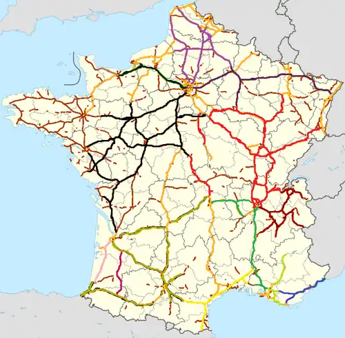
The FM 107.7 radio coverage is available in 2017 on 8902 kilometres of the (ASFA) network.[3] This is a list of highways that are updated in 107.7 FM every 15 minutes, live 24/7 (if the highway is said alone, it means that the station covers all around it):
Sanef 107.7 (1850km)
- Nord
- A1: Roissy-en-France - Carvin
- A2: A1 - Hordain
- A16: L'Isle-d'Adam - Boulogne-sur-Mer
- A26: Calais - Saint-Quentin
- A29: Neufchâtel-en-Bray - Saint-Quentin
- Est
- A4: Noisy-le-Grand - Reichstett
- A26: Saint-Quentin - northern Troyes
- A314
- A315
- A344
- Ouest
- A13: Orgeval - Caen
- A14: Carrières-sur-Seine - Orgeval
- A29: (Beuzeville - Saint-Saëns; outside Normandy)
- A132
- A139
- A154
- A813
Autoroute INFO (2487km)
- Centre-Est (live from Dijon)
- A5: Lieusant - Langres
- A6: Fleury-en-Bière - Limonest
- A19: Courtenay - Sens
- A26: northern Troyes - southern Troyes
- A31: Beaune - Toul
- A36: Beaune - Mulhouse
- A39: Dijon - Bourg-en-Bresse
- A40: Mâcon - Bellegarde
- A46: Anse - Vaulx-en-Velin
- A71: Bourges - Clermont-Ferrand
- A77: A6 - Cosne-Cours-sur-Loire
- A105
- A311
- A391
- A406
- A411
- A430
- A714
- Rhône-Alpes (live from Chambéry)
- A40: Bellegarde - Le Fayet
- A41: Genève - Chambéry - Grenoble
- A42: Bourg-en-Bresse - Vaulx-en-Velin
- A43: Saint-Priest - Chambéry - Tunnel du Fréjus
- A48: Bourgoin-Jallieu - Saint-Égrève
- A49
- A51: Le Pont de Claix - Col du Fau
Environment
99% of the privately managed network is protected by natural fencing.[3]
Privately managed motorways have 1764 wildlife crossing structures.[3]
See also
- Transport in France
- List of controlled-access highway systems
- Evolution of motorway construction in European nations
References
- ^ Bilan de l'accidentalité de l'année 2015
- ^ a b c d e 2017 CHIFFRES CLÉS (PDF) (Report) (in French). Association des sociétés françaises d'autoroutes - ASFA. 2017.
- ^ a b c d e 2018 CHIFFRES CLÉS (PDF) (Report) (in French). Association des sociétés françaises d'autoroutes - ASFA. 2018.
- ^ "Statistics - Eurostat". Eurostat. Retrieved 2024-03-01.
- ^ a b ICTAAL INSTRUCTION SUR LES CONDITIONS TECHNIQUES D'AMÉNAGEMENT DES AUTOROUTES DE LIAISON (PDF) (Report) (in French). Sétra - Service d'études sur les transports, les routes et leurs aménagements. 12 December 2000 – via DTRF - Documentation des Techniques Routières Françaises.
- ^ by definition motorways are forbidden to pedestrians
- ^ a b c d 2016 SÉCURITÉ SUR AUTOROUTE - ACCIDENTS MORTELS - CHIFFRES CLÉS (PDF) (Report) (in French). Association des sociétés françaises d'autoroutes - ASFA. 2016.
- ^ a b c d 2016 SÉCURITÉ SUR AUTOROUTE - ANALYSE DES ACCIDENTS MORTELS ET CORPORELS (PDF) (Report) (in French). Association des sociétés françaises d'autoroutes - ASFA. 2016.
- ^ "État de l'insécurité routière | Observatoire national interministériel de la sécurité routière". Observatoire national interministériel de la sécurité routière (in French).
- ^ Code de la route : Chapitre Ier : Autoroutes. (Articles R421-1 à R421-10), retrieved 6 August 2022,
I.-L'accès des autoroutes est interdit à la circulation :
- ^ "Gilet et triangle de sécurité". Ministère de l'Économie des Finances et de la Souveraineté industrielle et numérique (in French). 23 October 2020.
- ^ Press release of 12-14-2005 Archived November 20, 2006, at the Wayback Machine
External links
 Media related to Autoroutes in France at Wikimedia Commons
- Official Website of the ASFA, with information on the Autoroute network and instructions on how to use them
- Motorway numbers in France (route log)
- The automatic tolling system in France: Liber-t
- Driving in France - autoroutes and other routes
- Go Camp France - List of French autoroute companies